“Spectacular scenery unlike any
other in the Northeast.”
| St. Regis Mountain NYSDEC Trailhead |
| Jenkin's Mountain Trailhead |
| Canoe Launch at Paul Smith's College |
| Buck Pond NYSDEC Campground |
| Historic St. John's in the Wilderness Episcopal Church |

Explore by interest:
 VIEW AREA MAPS Maps of the region to view or print.
Area Maps
 LOOKING for more information on Where to Stay and Where to Dine?
Plan Your Stay
 CARING for our favorite natural and recreational resources - See the new guide
Invasive Species Alert
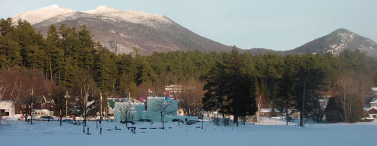
Saranac Lake Winter Carnival Ice Palace on the shore of Lake Flower is built every year the 1st two weeks of February, along Rt 3 on the Olympic Trail
Slush Pond Trails Trailhead
Adirondack Trail, State Rt. 30, near Paul Smiths in Franklin County
Walk or mountain bike on dirt roads and forest trails of the Slush Pond and Hays Brook area.
One has three options on this section of Hays Brook Area roads and trails. First is the Slush Pond Horse Trail, with the trailhead from Route 30 accessed by turning onto the dirt road opposite Hays Brook Area and continue for 1.3 miles to horse trail on the right. This a short stretch of single-track with a series of small hills, heading in a northwesterly direction through plantations and natural clearings to McColloms Road, with Route 30 about two miles down the road to the right.
Second option is the Slush Pond 7 mile loop: To turn this into a seven mile loop, turn right on Route 30 and travel another 2.3 miles back to Slush Pond Road. Turn right and continue for another 1.3 miles back to the starting point.
A third option is mtn bike riding, skiing, or snowshoeing into Slush Pond from Route 30 for 2.1 miles on seasonal road.
| Closest Community: | |
| Closest Byway: | Adirondack Trail |
| Distance from Byway: | on |
| Closest Route #: | State Rt. 30 |
| Months Occurring: | january, february, march, april, may, june, july, august, september, october, november and december |
| Best Season: | spring, summer, fall and winter |
| Best Time: | a enjoyable mountain bike |
| Indoors or Outdoors: | outdoor |
| Admission Fee: | no |
| Latitude: | 44.4768705388 |
| Longitude: | -74.2849465765 |


