![]()
“Spectacular scenery unlike any
other in the Northeast.”
| Red Dot Trails Trailhead |
| Canoe Launch at Paul Smith's College |
| JackRabbit Ski Trail Trailhead near VIC |
| Jenkin's Mountain Trailhead |
| Buck Pond NYSDEC Campground |

Explore by interest:
 VIEW AREA MAPS Maps of the region to view or print.
Area Maps
VIEW AREA MAPS Maps of the region to view or print.
Area Maps
 LOOKING for more information on Where to Stay and Where to Dine?
Plan Your Stay
LOOKING for more information on Where to Stay and Where to Dine?
Plan Your Stay
CARING for our favorite natural and recreational resources - See the new guide
Invasive Species Alert

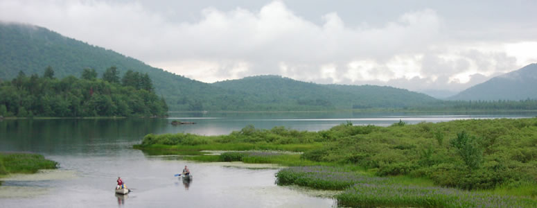
One of many canoeing opportunities along the Adirondack Trail Scenic Byway, Lewey Lake on NYS Route 30 between Indian Lake and Speculator
St. Regis Mountain NYSDEC Trailhead
Adirondack Trail, State Rt. 30, near Paul Smiths in Franklin County
A popular hike through a mixed hardwood forest leads to a south facing rocky summit and an abandoned fire tower with views of lakes and the distant High Peaks.
The footpath leading to the St. Regis summit is 3.4 miles long, 6.8 mile round trip, with 1,235 feet of vertical rise. Please sign in, and out, at the DEC trail register where the hike starts. A popular hike through a mixed hardwood forest to a south-facing rocky summit and an abandoned fire tower. The summit views encompass myriad lakes and the distant High Peaks. Also a popular ski and showshoe.
| Closest Community: | |
| Closest Byway: | Adirondack Trail |
| Distance from Byway: | remote |
| Closest Route #: | State Rt. 30 |
| Indoors or Outdoors: | outdoor |
| Admission Fee: | no |
| Latitude: | 44.4321264088 |
| Longitude: | -74.3002890105 |
| How to Find: | Rt 30 to Paul Smiths, N of intersection left on Keese Mills Road, trail head in 2.5 miles |
| URL: | St. Regis Mountain NYSDEC Trailhead website |