![]()
“Spectacular scenery unlike any
other in the Northeast.”
| Indian Lake Day Use and Picnic Area |
| Indian Lake Boat Launch |
| Jessup River Wild Forest |
| Snowmobile Crossing, Rt 28 near Indian Lake |
| Hudson Gorge Primitive Area |

Explore by interest:
 VIEW AREA MAPS Maps of the region to view or print.
Area Maps
VIEW AREA MAPS Maps of the region to view or print.
Area Maps
 LOOKING for more information on Where to Stay and Where to Dine?
Plan Your Stay
LOOKING for more information on Where to Stay and Where to Dine?
Plan Your Stay
CARING for our favorite natural and recreational resources - See the new guide
Invasive Species Alert

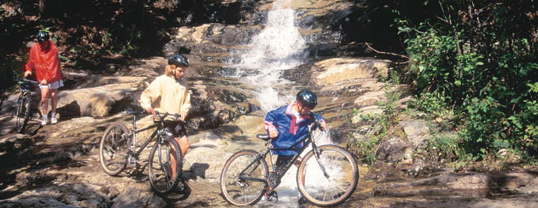
Mountain biking opportunities exist along each of the Scenic Byways, from scenic back roads to trails through the woods
Ross Pond NYSDEC Trailhead
Central Adirondack Trail, State Rt. 28, near Indian Lake in Hamilton County
A marked trail leads to Ross, Whortleberry, and Big Bad Luck Ponds.
The trailhead to this area is located on Route 28. A marked trail leads to Ross, Whortleberry, and Big Bad Luck Ponds. The largest wetland complex within the Hudson River Gorge area covers several hundred acres, surrounding Whortleberry, Cranberry, Big Bad Luck, and Rock Ponds, extending southeast to Bell Mountain Pond, then northeastward along Bell Mountain Brook. Many of the small ponds and wetlands situated within stream valleys have been created by beaver.
| Closest Community: | |
| Closest Byway: | Central Adirondack Trail |
| Distance from Byway: | on |
| Closest Route #: | State Rt. 28 |
| Indoors or Outdoors: | outdoor |
| Admission Fee: | no |
| Latitude: | 43.773572932 |
| Longitude: | -74.1144561768 |
| URL: | Ross Pond NYSDEC Trailhead website |