“Spectacular scenery unlike any
other in the Northeast.”
| Center of 10 Rivers Region/Coney Mountain Trailhead |
| Scenic Overlook on Piercefield Flow |
| Bluff Point on Tupper Lake |
| East Pine Pond Boat Access |
| Western Access to the High Peaks Wilderness Area |

Explore by interest:
 VIEW AREA MAPS Maps of the region to view or print.
Area Maps
 LOOKING for more information on Where to Stay and Where to Dine?
Plan Your Stay
 CARING for our favorite natural and recreational resources - See the new guide
Invasive Species Alert
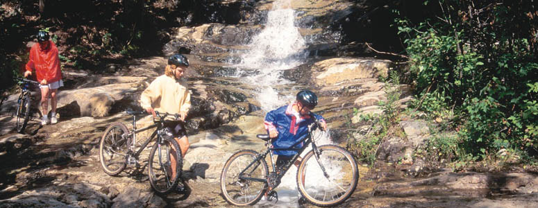
Mountain biking opportunities exist along each of the Scenic Byways, from scenic back roads to trails through the woods
Long Pond Canoe Access
Adirondack Trail, State Rt. 30, near Tupper Lake in Franklin County
Two miles long and 338 acres, Long pond is the second largest pond in the Saint Regis Canoe Area, with two islands, and 18 campsites in the vicinity.
Coordinates indicate a location in Floodwood, on Floodwood Road between Derrick to the west and Saranac Inn to the east, reached by 0.25 carry from Floodwood Road.
| Closest Community: | |
| Nearby Communities: | Saranac Lake |
| Closest Byway: | Adirondack Trail |
| Distance from Byway: | remote |
| Closest Route #: | State Rt. 30 |
| Best Season: | spring, summer and fall |
| Indoors or Outdoors: | outdoor |
| Admission Fee: | no |
| Latitude: | 44.3462080031 |
| Longitude: | -74.4218756114 |


