![]()
“Spectacular scenery unlike any
other in the Northeast.”
| Newton Falls Bike Loop |
| Star Lake NYSDEC Boat Launch |
| Wanakena Footbridge |
| Aldrich Pond Wild Forest |
| Wanakena Ranger School, SUNY ESF |

Explore by interest:
 VIEW AREA MAPS Maps of the region to view or print.
Area Maps
VIEW AREA MAPS Maps of the region to view or print.
Area Maps
 LOOKING for more information on Where to Stay and Where to Dine?
Plan Your Stay
LOOKING for more information on Where to Stay and Where to Dine?
Plan Your Stay
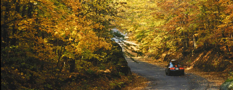
Autumn is a great time for a drive along the Adirondack Scenic Byways of northern New York
Aldrich Pond Wild Forest Hiking Trails Access
Olympic Byway, County Rt. 3, near Star Lake in St. Lawrence County
Cranberry Lake, the northern gateway to the Five Ponds Wilderness, covers 11 square miles, has 55 miles of shoreline, more than 40 miles of which are state-owned.
The 5PWA covers 107,230 acres between Cranberry Lake and Stillwater Reservoir and contains some of the best remote wilderness in the Adirondack Park. Trails are mostly in the northern part, leaving much of the area trailless. However, one of many excellent trail access points is as follows: The red, 15 mile High Falls Loop trail begins at the parking lot on the South Shore road in the Hamlet of Wanakena at the start of the Dead Creek Flow Trail. The first two miles follow the bed of a logging railroad. In the mid 1930's, it was upgraded to a truck trail for state administrative use. It is now used only as a foot trail, in conformance with wilderness management guidelines.
| Closest Community: | |
| Closest Byway: | Olympic Byway |
| Closest Route #: | County Rt. 3 |
| Latitude: | 44.1516234847 |
| Longitude: | -75.0282444009 |