![]()
“Spectacular scenery unlike any
other in the Northeast.”
| Harrisville Overlook of the Oswegatchie |
| Cross Country Ski Trails near Jerden Falls |
| Cross Country Ski Trails near Kimball Mill |
| Green Pond Trail in Bonaparte's Cave State Forest |
| Town of Diana Museum |

Explore by interest:
 VIEW AREA MAPS Maps of the region to view or print.
Area Maps
VIEW AREA MAPS Maps of the region to view or print.
Area Maps
 LOOKING for more information on Where to Stay and Where to Dine?
Plan Your Stay
LOOKING for more information on Where to Stay and Where to Dine?
Plan Your Stay
CARING for our favorite natural and recreational resources - See the new guide
Invasive Species Alert
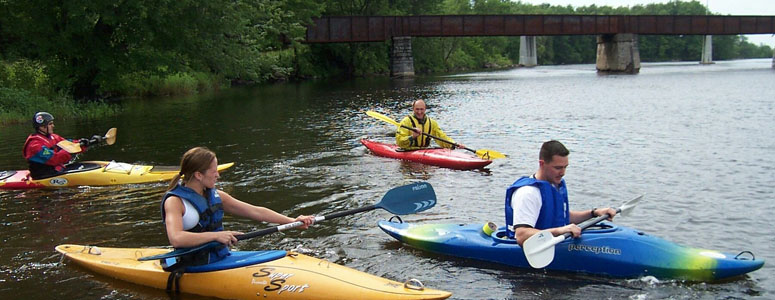
Learning a new skill is a great way to spend the day on a trip along the Adirondack North Country Scenic Byways (by Teri Ellis)
Adirondack Park Boundary near Harrisville area
Olympic Byway, County Rt. 3, near Harrisville in Lewis County
The Adirondack Park boundary, commonly known as The Blue Line, contains the entire Adirondack Mountain range and surrounding areas, all within the state of New York.
The original boundary enclosed a much smaller area than today, only 2.8 million acres, with a noticeable shift southwest of the modern park's center, excluding the more developed eastern and northern regions. This map with its blue boundary line, still the traditional representation of the park's boundary, provided the state with a focus on where to acquire lands for the Forest Preserve. The boundary line today delineates a 6.4 million acres checkerboard mix of public and private lands.
| Closest Community: | |
| Closest Byway: | Olympic Byway |
| Distance from Byway: | on |
| Closest Route #: | County Rt. 3 |
| Indoors or Outdoors: | outdoor |
| Admission Fee: | no |
| Latitude: | 44.2279888892 |
| Longitude: | -75.2029304772 |