“Spectacular scenery unlike any
other in the Northeast.”
| High Peaks Wilderness Area |
| Mt Arab Trail and Fire Tower |
| Deer Pond Loop Trailhead |
| Follesby Clear Pond Boat Access 2 |
| Middle Pond Canoe Access |

Explore by interest:
 VIEW AREA MAPS Maps of the region to view or print.
Area Maps
 LOOKING for more information on Where to Stay and Where to Dine?
Plan Your Stay
 CARING for our favorite natural and recreational resources - See the new guide
Invasive Species Alert
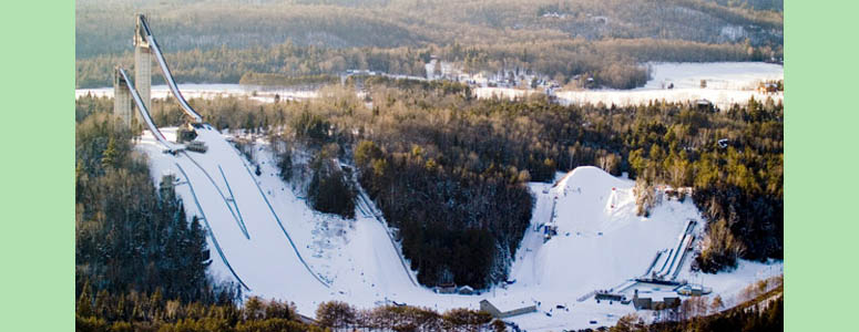
The 1980 Olympic Ski Jumps regularly feature events and are located along the Olympic Trail Scenic Byway near Lake Placid
Indian Carry to Upper Saranac Lake
Olympic Byway, State Rt. 3, near Tupper Lake in Franklin County
Indian Carry is a hand launch site with parking for 18 cars and crosses from Upper Saranac Lake to Stony Creek Ponds and Raquette River.
On Route 3, eight miles east of the Village of Tupper Lake with beach launching, parking for 18 cars, fishing access, and a handicapped-accessible path to dock. NYS DEC managed. This resource is in Section 1 of the Northern Forest Canoe Trail, a 740-mile water route extending from Old Forge in the Adirondack Park to Fort Kent, Maine.
| Closest Community: | |
| Nearby Communities: | Saranac Lake |
| Closest Byway: | Olympic Byway |
| Distance from Byway: | near |
| Closest Route #: | State Rt. 3 |
| Best Season: | summer |
| Scenic View: | Water views on Upper Saranac Lake and the Raquette River. |
| Indoors or Outdoors: | outdoor |
| Admission Fee: | no |
| Latitude: | 44.2301345689 |
| Longitude: | -74.3155402319 |


