“Spectacular scenery unlike any
other in the Northeast.”
| Siege of Fort Stanwix Historic Marker, Rome |
| Rome Capital Theatre |
| Fort Newport Historic Marker |
| Rome Sports Hall of Fame and Museum |
| Fort Stanwix National Monument |

Explore by interest:
 VIEW AREA MAPS Maps of the region to view or print.
Area Maps
 LOOKING for more information on Where to Stay and Where to Dine?
Plan Your Stay
 CARING for our favorite natural and recreational resources - See the new guide
Invasive Species Alert
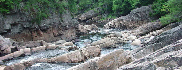
The view of Griffin Gorge and waterfall is well worth the trip, a few miles north of the Rt 8 and 30 intersection between Speculator and Wells on the Adirondack Trail
Fort Williams and Upper Mohawk Landing, Historic Marker
Central Adirondack Trail, State Rt. 365, near Rome in Oneida County
Historic marker indicating site of Fort Williams, which guarded the Upper Mohawk Landing from 1755-1756 and was burned in a panic by British General Webb.
| Closest Community: | |
| Closest Byway: | Central Adirondack Trail |
| Distance from Byway: | near |
| Closest Route #: | State Rt. 365 |
| Indoors or Outdoors: | outdoor |
| Admission Fee: | no |
| Latitude: | 43.2238751481 |
| Longitude: | -75.4645873113 |


